


Workflow automation to urban planning procedures in the general authority of urban planning in Riyadh municipality to fully automate the diagrams approval cycle along with advanced geo-processing capabilities and high quality printing capabilities.
The solution aims at automating the workflow procedures related to urban planning procedures and its land
management related procedures using dynamic workflow engine and making full use of GIS, the dynamic workflow
engine relates the department business workflow with GIS and provides the department the ability to change
the workflow steps dynamic without the need to develop anything, the solution main objective was to minimize
the time required for the urban plans approval cycles from one year cycle into six months cycle.
The solution was developed on top of Microsoft Dynamic Workflow Engine and entitled a lot of re-engineering
procedures to minimize the diagrams approval cycle time and to cut the gap in communication between the
engineering offices and the general authority. The solution entitles two main interfaces, one interface
published over the internet that targets the engineering offices from which they can manipulate the jobs
from their side and submit the necessary documents and information, another internal web interface was
developed to the department officers to manipulate the jobs from the general authority perspective.
Excessive Geo-processing models were implemented to automate as much as possible in the approvals cycle.
Integration occurred with different agencies to provide the maximum automation capabilities and letters
printing module was also developed to automatically print the letters to the different agencies based on the
job type and step.

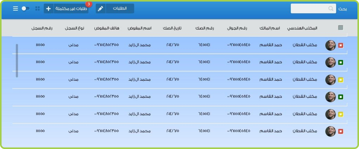
Engineering offices web interface allows engineering offices to explore their job inbox and submit new
applications, the interface allows the engineering office to submit the solution CAD drawings that include
the diagram boundaries geo-referenced, the system automatically validates the files and imports the GIS data
into the geo-database, the engineering office fills the required information and uploads the necessary
documents. Once the application is submitted, the job is being created and is transferred automatically –
following the designed workflow steps – to the department officers, the officers have the ability to explore
the application information and geographic data and either accept or reject the application. If the
application is rejected, it is returned back to the engineering office with the rejection comments so that
the office can re-submit the CAD files, when the job is approved, the job is moved as per the WF designed
steps.
The jobs are then moved to the different workflow steps including the first submission, second submissions,
diagrams issuing, percentages calculations and spatial validations enforcements and much more.
The solution logs all the jobs in time fashion GIS layers so that supervisors can preview the progress of
the jobs and submissions over time and automatic KPIs are generated in order to monitor the department and
engineering offices performance.
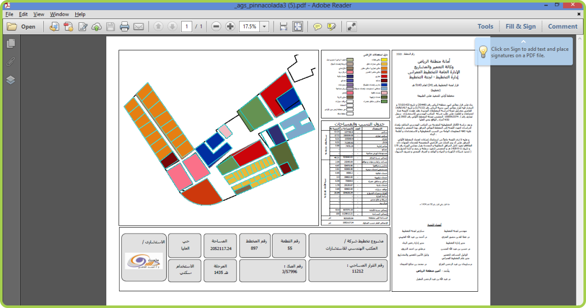
The solution empowers the department with many tools such as the spatial validation tools that validate the
engineering offices submitted CAD files with automatic calculation to each urban plan parcels, percentages
of areas, fulfill of spatial validation criteria.
The solution also empowers the engineering offices and the department officers with high quality printing
tools that help in printing high quality diagrams (A0) with one click, the high quality printing
capabilities ensure standardization in the department diagrams as all diagrams are printed from the system
using the department templates.
The developed solution is the first to implement dynamic workflow capabilities that are geo-enabled within Riyadh municipality and resulted in minimizing the jobs time to six months instead of one year.
The developed solution is built using dynamic workflow engine and adds a lot of values such as:
• System extendibility and maintainability by easily changing the workflow steps from the visual
workflow
designer.
• The proposed solution cut time of the urban plans approvals from one year to six months’ time.
• Automatic updates to the centralized geo-database with the approved diagrams parcels which reflect how up
to date the geo-database is.
• Easy communication between the engineering offices and the departments with the ability to monitor the
jobs and identify the latency gaps and reasons.
• Standard diagrams across the department.
• Less time from engineering offices, the diagrams of the whole plan and each parcel are generated following
the department templates in just one click.
• Better quality to the approved diagrams by utilizing the geo-processing in the calculations.
• Easy to retrieve any information using the web browser.


